

SRP2: disaster resilience: Community Digital twins
When floodwaters strike, communities and first responders lack real-time information on flood-induced roadway closures and corresponding evacuation routes. Moreover, despite the wealth of research on flood-induced roadway access, a significant knowledge gap remains, particularly in network-level analysis. Existing flood-monitoring approaches primarily rely on sparse sensor networks, thereby providing limited real-time data and insufficiently capturing indirect impacts of flooding on noninundated roadway segments. This gap complicates emergency response, delays evacuation, and undermines postevent recovery efforts.
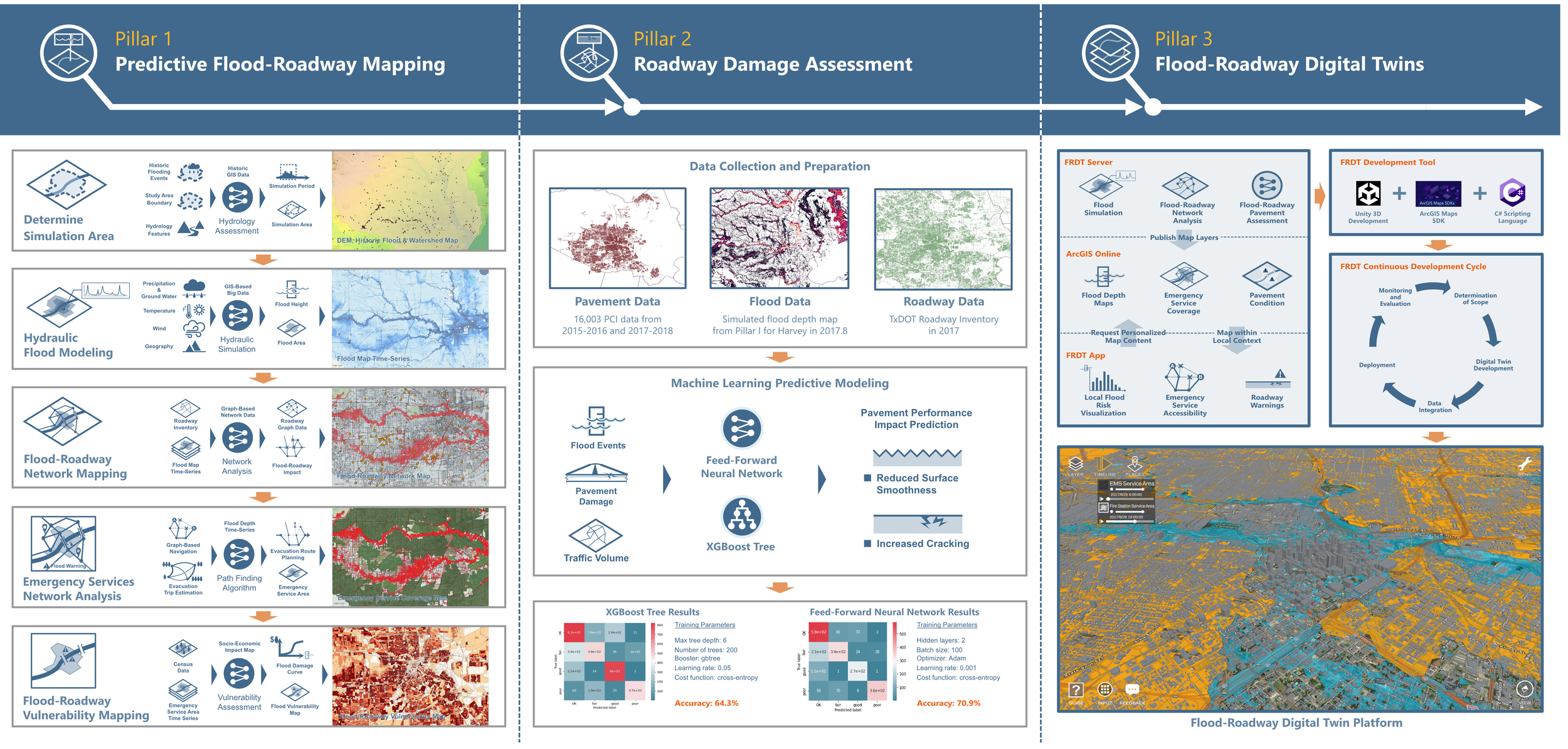
We research the development of a digital twinning platform that visualizes flood-induced roadway damage and access routes during extreme events and predicts optimal routes to reach victims. By consolidating heterogeneous datasets, including historical traffic volumes, pavement conditions, hydrological data, and weather forecasts, we investigate whether this cyber-enabled platform can help connect coastal communities, first responders, and local infrastructure practitioners with the predictive information they need. We claim that this digital twining hub and its associated toolkits can save time and lives, increase the likelihood of successful evacuation and rescue, and improve infrastructure management practices for transportation agencies.
This research project is formulated under award # NA22OAR4170092 from the National Oceanic and Atmospheric Administration, U.S. Department of Commerce.